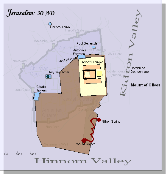
Use these links to view a map of Jerusalem through the ages. Be sure to read the descriptions below the map.
Map 1 | Map 2 | Map 3 | Map 4 | Map 5 |

- By the time of Christ, King Herod the Great had expanded the Second Temple making it into a gloriously large structure, much larger than Solomon’s temple. It included Antonia’s Fortress to the north.
- Hezekiah’s tunnel still fed the Pool of Siloam (where Jesus healed the blind man in John 9:7)
- On the west side of the city, Herod built the Citadel Towers and his palace just to the south.
- The traditional spot for Calvary was just outside the city wall, on the northwest side of the city.
- The Pool of Bathesda (where Jesus healed the lame man who couldn’t reach the waters that were stirred by the angel) was on the north side of the Temple (John 5:2)
- Despite the excess and disrespectful sacrifices conducted in the Temple, Jesus called it “His Father’s house” (Luke 2:49, John 2:16)
- After rejecting Christ, the Temple was destroyed by the Romans in 70 AD, just as Jesus had prophesied in Matt 24:1-2).
This map depicts the walls of Jerusalem in the time of Christ.
